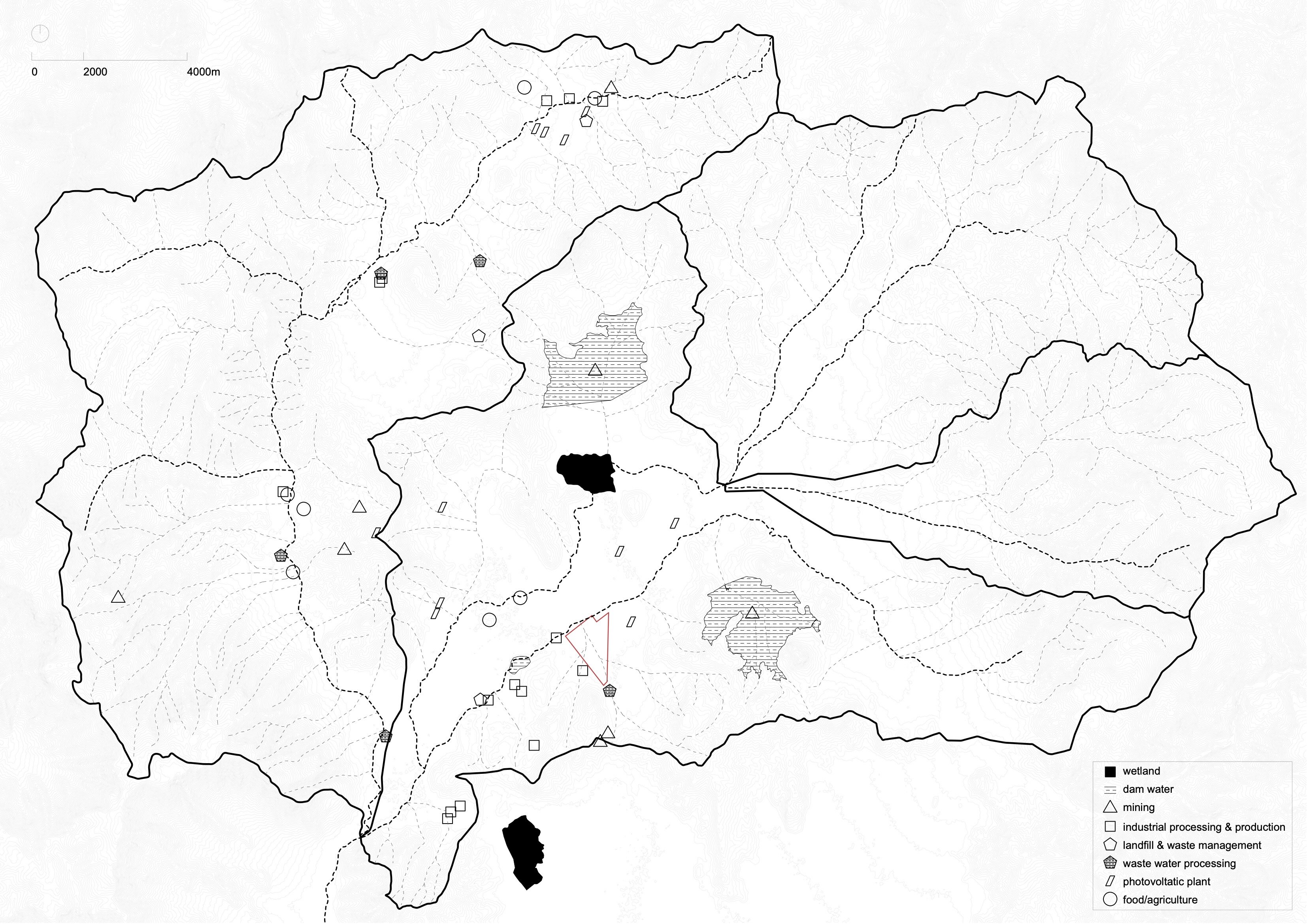
Tiltil: Watershed
The watershed of Tiltil is divided into two parts: The west part of the watershed receives water primarily from the mountains in the western Coastal Range (Cordillera de la Costa). The east part is fed by water sources from mountains in the east, which belong to the province nearby. These two water systems merge in the south of Tiltil, forming a single watercourse that continues downstream.
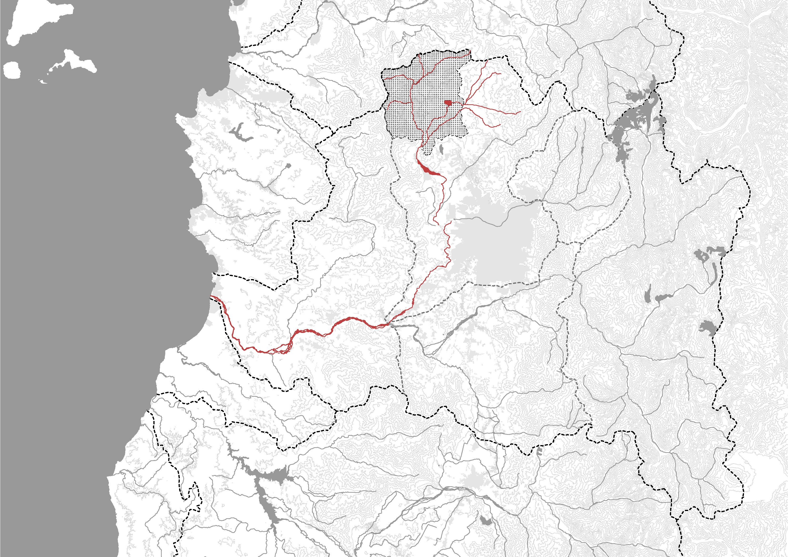
When we zoom out and look into a bigger scale, we find Tiltil located in the upper stream of the regional watershed that leads towards the sea. It means that any water pollution or mismanagement in Tiltil can have significant consequences for communities and ecosystems further along the watershed.
In addition, Tiltil is situated along the Pacific Ring of Fire, a geologically active zone characterized by volcanoes, earthquakes, and tectonic activity. One of the key environmental concerns for the region is the risk of an earthquake compromising the integrity of industrial dams. These dams hold contaminated water and industrial waste, particularly from mining and cement production. If a strong earthquake were to damage or break these structures, it could lead to toxic water flooding the town and polluting the watershed. Given Tiltil's upstream position, any such disaster would not only affect local communities but also contaminate water sources for regions downstream. This highlights the importance of responsible industrial water management and disaster preparedness to safeguard the watershed and the people who depend on it.